Walking, Cycling or Riding
Being about half-way along the Essex Way, the village makes an ideal start/end-point for visiting the local countryside or exploring history.
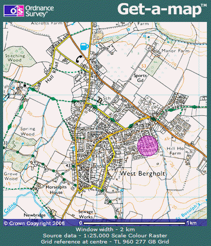
Visit the Ordnance Survey Get-a-map service to track possible routes or buy OS Explorer map 184. There are also quite a few local walks to try on this site; they range from walks that follow a history trail around the village to walks a short drive away (see menu) including:
- West Bergholt History 1 & 2,
- Joe Firmin,
- Heaths & Greens,
- Fordham Country Trail,
- Miller’s Drift,
- Margery Allingham,
- The Fair Maid,
- Talking Benches.
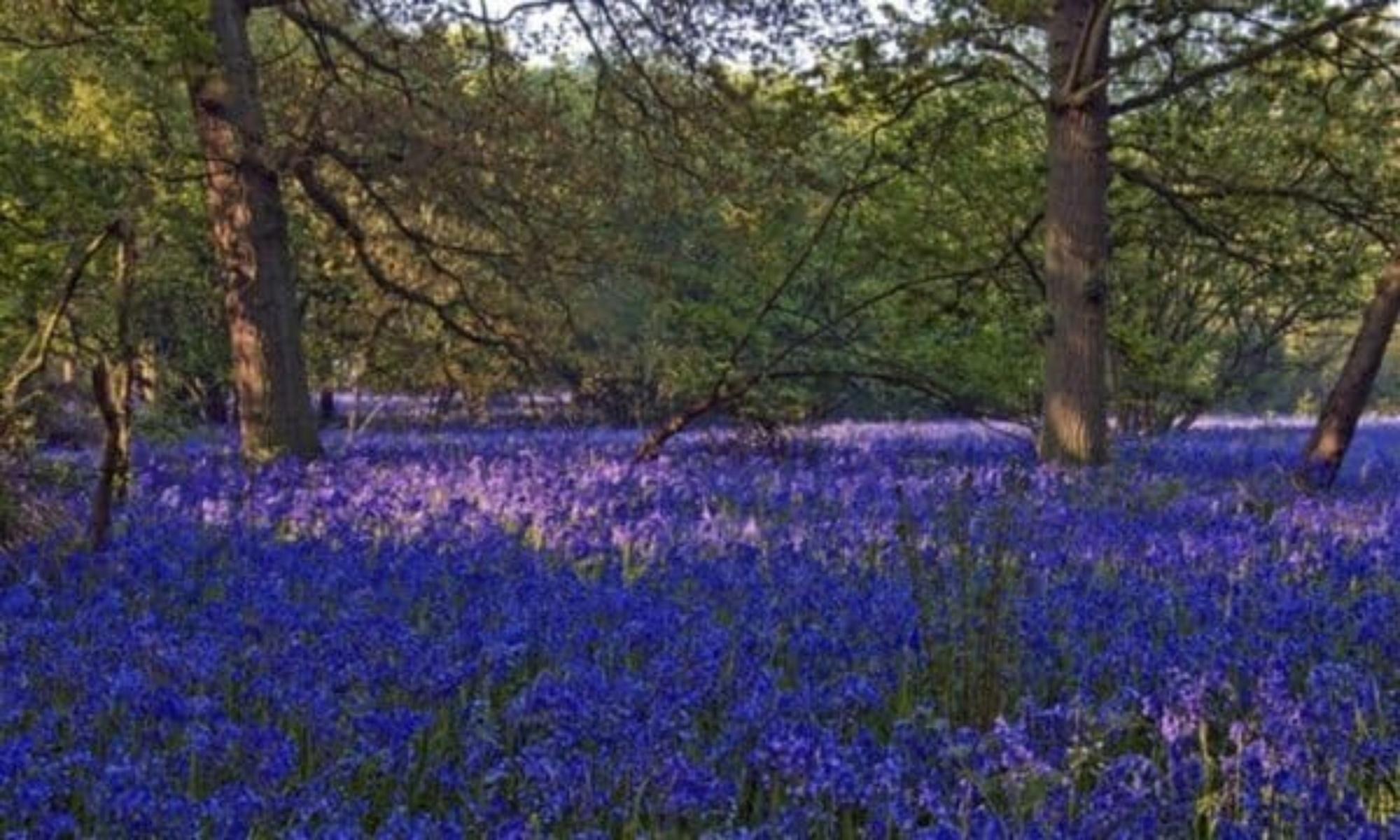
… each of which has its’ own tale to tell. There are also guided and self-guided Hillhouse Wood Wildlife walks that you can find out about here.
Country Code
Don’t forget to follow the country code when out and about:
- Enjoy the countryside and respect its life and work,
- Guard against all risk of fire,
- Fasten all gates,
- Keep your dogs under close control,
- Keep to public paths across farmland,
- Take your litter home,
- Leave livestock, crops & machinery alone,
- Use gates and stiles to cross fences, hedges and walls,
- Help keep all water clean,
- Protect wildlife, plants & trees,
- Take special care on country roads,
- Make no unnecessary noise.
Cycling
Jump here for Bridleways info. Other walks to try include the:
- Colchester Orbital & Mayland Community Routes which you can follow with an Interactive map;
- Essex Way running from Greenstead to Wrabness,
- Walking in England website with free downloadable maps to follow with walks from half a mile to 12 miles plus, and
- Colchester’s Roman Wall walk,
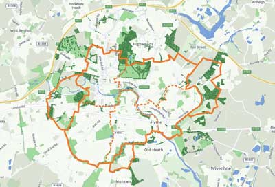
Colchester Orbital
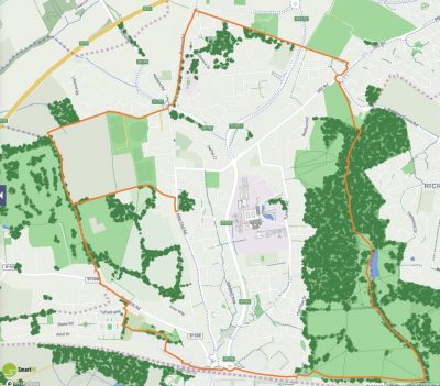
There is now a large network of interconnected footpaths and cycleways around & through Colchester. It provides 13 – 14 miles of walks or cycle routes around town connecting some of the main green spaces following public rights of way and off-road paths.
Interactive

The interactive maps (links below) enable users to display and interact with walk/cycle routes in the context of multiple additional layers of environmental and heritage information. They will also help you find practical information about connecting transport options and other facilities. The two maps are currently web-based only. PDF versions of the Orbital walk/cycle routes, with full colour maps and route guidance, are however available via mobiles.
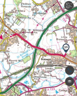
The routes are quite easily accessible from West Bergholt as follows:
Access to the Main Colchester Orbital
The route along the Braiswick Road links into the Orbital just after the Golf Club.
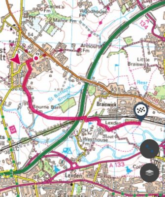
 | The Orbital Routes – click the map to link to an interactive version
 |
Access to the Myland Community Route
This access route spends more time on footpaths than road:
The Essex Way
81 miles long, the Essex Way runs from Epping to Harwich via West Bergholt. It crosses the old Roman Road between London & Colchester about halfway between Epping & Ongar. Other sights en-route include:
- Greensted Church – built about 645 AD it is believed to be the oldest wooden church in the world.
- Willingale Churches – one churchyard, two churches!
- Pleshey – Norman castle earthworks.
- Terling Windmill.
- Cressing Temple.
- Coggeshall Abbey.
- Paycocke’s House.
- Chappel Viaduct.
- West Bergholt.
- The ‘Dumb Animals Humble Petition’.
- Dedham Vale AONB.
- Wrabness Bell-Cage.
The following booklet about the Essex Way was issued by ECC in 2008.
 Loading...
You can find more walks promoted by Essex County Council here.
Walking in England
Another source of walks further afield in Colchester, Essex & beyond is John Harris’s Walking in England website. This covers a large number of walks in varied formats (caution, they might sometimes be slightly out of date1 so do your due diligence first), and also links to many walking clubs:
Colchester’s Roman Wall Walk
Loading...
Equestrian
Sadly, West Bergholt is less well-served with bridleways although efforts are being made to extend the East Anglian Farm Rides scheme further around the area. East Anglian Farm Rides has over 250 miles of off-road tracks and headlands on over 55 farms in Essex. These rides afford wonderful access through rolling farmland. To see the latest updates on rides available visit their website for the latest map centred on West Bergholt.
For more details about the scheme either check out their website or contact the scheme organiser, Robert Bunting, by email or on 01376 570334.
Lessons & Livery

If you want to learn how to ride to enjoy this different approach to the countryside, Park Farm Riding Centre provides lessons (but not hacking out) in Westwood Park Road, West Bergholt – they can be contacted on 01206 271535.
If you have your own horse there is also a livery yard right in the village at Armoury Farm Livery Stables, Armoury Road, West Bergholt – they can be contacted on 01206 241939.
Footnote
- A walk quite local to the webmaster starts from a car park that still exists on the map but was closed & blocked some years ago due to regular traveller incursions.
Comments are closed.