West Bergholt History Walk #1
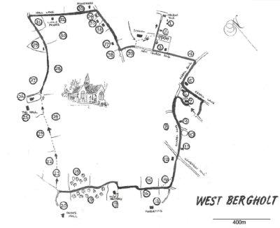
This walk was originally published by B Skudder & D Fulford of the Local History Group in May 1986 so some of the village scene has changed but the walk is still valid and most (if not all?) of the buildings still in place.
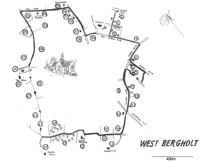
There is a larger image of the route at the end of this article.
If you would rather use a printed copy then please download the following PDF file – it will squeeze onto 3 pages if printed double-sided.
Introduction
With the passing of the Brewery, West Bergholt now seems set to become a dormitory village for Colchester, and to the casual viewer offers little in the way of historical interest.
In the not-too-distant past West Bergholt has been called ‘a village of cowkeepers’ and ‘the most ignorant village in the County’. This short walk around the village is the first of several planned to give some insight into the background of the village and the events that have shaped its present form.
The walk is approximately 3½ miles long and takes in the one-time area of the Heath (now built over), as well as the wooded countryside and agricultural land that still restrain the housing development.
You are starting your walk from the Heathlands School, opened in 1858. There have been several alterations and extensions which have reflected the needs of the village, and now only one small part of the original building remains. The area surrounding the School ‘is the last remaining part of the Heath, which used to cover an area of over 312 acres; from the north of the Parish down to Newbridge Hill and from Lexden Road across to beyond Chapel Lane.
Your walk will cover some of the areas which were once Heath. Although over the centuries some settlement had taken place, it was not until the late 18th.century that a survey suggested that the Heath and Waste land was a potential source of income, both in agricultural terms and for the private individual.
In 1865, by an Act of Parliament, the Heath and Waste Land of West Bergholt was enclosed, the whole being parcelled into small plots of land and sold to many inhabitants of the Parish.
Follow the footpath past the School and turn left at the end, into School Lane .
1 The Site of the Old Mill House and Windmill
Robert Springett was the miller here in 1841, living with his wife Charlotte and their six children. There was an acre of land behind ‘The Treble Tile’ (then a beer house), which included a cottage and a windmill, the latter being a post-mill containing two stones and having a brick roundhouse . In 1878, the windmill was described as ‘capable of being put into good going order’ , but by 1941, when the Mill House was sold , there was no mention made of the windmill .
Retrace your steps. On your left you will see….
2. Fir Villa
For many years this was the home and business premises of Mr. Solomon Raven, a local butcher. Hemp Lane used to run where Bell’s Yard is today.
At the end of School Lane, turn left into New Church Road.
3. St. Mary’s Church
This land was formerly part of the Heath. In 1865, the Enclosure Commissioners gave this site for a New Church and burial ground, although the Church was not in use until 1904. It was felt that a new church was needed to replace the Old Church (see 26) which was ‘inconveniently placed for the inhabitants’ and was in need of repair.
4. The Allotments
Again, part of the Heath. This land was given in 1865 for ‘the labouring poor’ of the parish. The Allotments along the Colchester Road had been in existence for many years before this and were called ‘The Common Garden’.
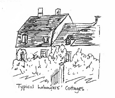
Turn right at the end of New Church Road into Chapel Road and cross over. Many of the houses along here date from 1865 onwards, when the land bordering the track across the Heath was sold.
5. The Methodist Church
Methodism has been active in the village since the early 19th century. This Chapel was erected in 1879 to replace a smaller building. (see 9)
On the opposite corner is…
6. The Post Office
 This is the third site of the Post Office in the village. This building has seen several changes of use – originally a pork butcher’s (Pudney’s), then a sweet shop, a garage with petrol pumps and finally, the Post Office.
Turn left into Chapel Lane. This is ·the start of the Chapel Lane ‘Enclosures’, an area interesting in terms of the almost random siting of houses and the narrow winding roads. Many small cottages grew up on the Heath in this area, housing agricultural labourers, brickmakers, carpenters, etc. The roads follow a route which was dictated by the presence of these cottages and were ‘formally’ laid out as roads (usually fifteen to twenty feet wide) in 1865, by the Enclosure Commissioners.
Take the first turning on the right, and then turn right again down the footpath before the bungalow ‘Salix’.
At the end of the footpath you will see…
7. Spring Cottage etc.
These cottages and their gardens were shown on a map of 1843 and give some idea of the size of the enclosures that had grown up on the Heath. At the end of the road, turn left, and continue walking along Chapel Road. To your right lies….
8. The Site of Ardens
This was a small farm with 9 acres of land bought by Daniel Partridge in 1725. (His tombstone can still be seen in the Old Church graveyard). He left the farm to his son, Thomas, who rented it to Samuel Bradbrook, who later bought the farm. The name was changed to Dairy Farm and was still in the Bradbrook family’s hands in 1886. In 1895, the name changed yet again to Denard Lodge, and in 1906, Lionel Upton bought the property. (Hence Upton Close). The land has since been used as a gravel pit, infilled, and today supports a new housing estate.
9. The Hairdresser’s
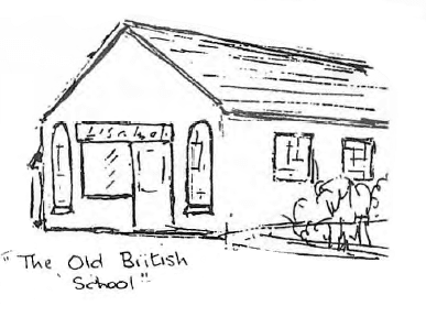 The windows give a clue to this building’s former use …. this was the Methodist Chapel built in 1838 to replace a small meeting house which was opposite the Brewery. In 1871, this building was reconstructed and became the British School with 90 children attending.
The British School closed in 1901, the children transferring to the ‘Heathlands’ School. Later the building was used as a Sunday School and sold in 1949.
10. The Pond
This pond was appointed by the Enclosure Commissioners in 1865 as a Public Pond and Watering Place.
11. Mount Pleasant
In 1843 this was an ‘old enclosure ‘ rented by a Mary Alston. (The Alston family can be traced back in the village to the early 1700’s.) By 1857 James King Seaborne was the owner of Mount Pleasant and also Vine Cottage which used to be behind the house. He was a wheelwright and the premises consisted of cottages, shops and gardens. His gravestone is in the Methodist Churchyard and tells that he was a Local Preacher …. and through his exertions the New Chapel was erected. He died in 1885.
Cross over the Newbridge Hill and continue into Cooks Hall Lane.
12. The Site of Red Barn Farm
At one time a dairy farm, this has also been a petrol filling station run by Mr. Barrow. He had a cattle truck and used to transport the farmers’ livestock. One of the original barns can be seen in the garden of the corner house.
Turn right at the end of this lane. The small private road straight ahead leads to….
13. Horsepits
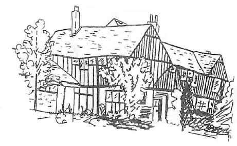
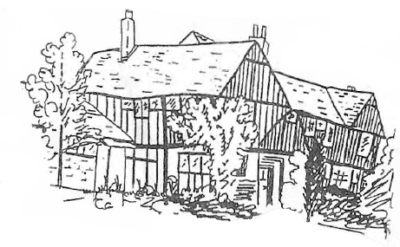 This is a large timber-framed house, built in the early 16th century. The name is believed to derive from Stephen Horsepet (1385) who owned lands at Great Horkesley. In 1595, a clothier, William Dibney, left ‘Hawspease’ to his son, allowing his widow £10 a year and the use of the front parlour so long ‘as she kept herself a widow’. There was a secret room found here in the Second World War with the initials D T S and the date ‘November 10, 1628.’ There are also wall paintings in the house.
14. The Crossroads
The present road layout was set out by the Enclosure Commissioners in 1865. The dotted line on your map shows the original track across the Heath.
15. Four Acres Field
A common type of field name, usually indicating the approximate area of the field.
16. Heath Field
 One of several Heath Fields in the Parish, signifying the proximity of the field to the Heath.
17. The Old Rectory
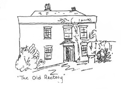
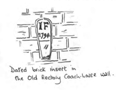
Built in the 18th century, this was the Rectory attached to the Old Church. In the 1820’s the then Reverend Sims held a school here in an attempt to start a Church School. As you continue your walk notice the distance between the Old Church and this Rectory.
18. Grove Wood
An ancient wood, once ‘Grovefeld Coppice’ given to the monks of St. John’s Abbey in Colchester. In 1843 it was known as Sims Grove, probably after the Reverend Sims who lived at the Rectory. All the woods in the parish were rented out to the hurdle maker in the 1840’s.
19. Spring Wood
This wooded area now shelters a nudist camping site. At the end of this lane, on your left, is a track leading to….
20. Cooks Hall
This is one of the two manors in the parish and was originally known as Netherhall. The lands of the manor were mentioned in the Domesday Survey in 1086. In 1492, the manor was left to the monks of St. John’s Abbey in Colchester, so that prayers would be said for the previous owner, and it later came into the hands of the Abell family who were wealthy clothiers. The records of this manor date back many hundreds of years.
Part of the house dates back to the 16th century and is of timber-frame construction. The main block dates from the 18th century.
Turn right along the footpath that leads across the fields. You are now walking along….
21. The Essex Way
This is a footpath that runs across the County, often using ancient trackways.
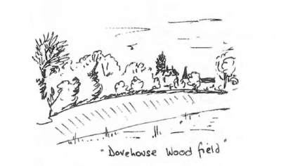
 22. Upper Dovehouse Wood Field
This field name may refer to the dovehouse which was usually found close to the manor house. The doves used to be kept to provide meat in the winter months.
23. Cooks Hare Field
24. Barn Field
 25. West Bergholt Hall
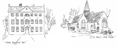
Built about 1772, the manor of Bergholt Sackville is centred upon this site. The manor was mentioned in the Domesday Survey of 1086 and for several hundred years was held by the Sackville family, descendants of the Norman ‘conquerors’. The records of the manor date back to the 15th century.
26. St. Mary’s Old Church
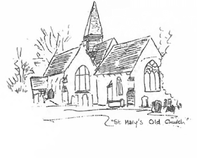 Excavations have dated part of the north wall of the Church to c 1100. The Church itself has a few 17th century grave slabs and as early as 1331 a chantry was founded here by James de Bures so that prayers would be said for him at the altar. Tombstones in the graveyard date from 1737, but the ground has probably been filled several times over. This Church, like many others in the County, is situated next to the manor house rather than near the village population and demonstrates the close relationship between the Lords of the Manor and the Church.
The Church was altered to its present form by the 14th century and inside has a children’s gallery dating back to the late 18th century. Several rows of wooden hat pegs still survive, and the timber-framed belfry contains one bell. Georgian Coat of Arms, dating to c. 1826 are on the front of the gallery, but wall paintings , including, it is believed earlier Coat of Arms, have been found on the wall above the chancel arch. St. Mary’s is now maintained by the Redundant Churches Fund, one of only three in Essex.
Continue walking down the lane, and notice, on your right, the remains of the hedge-layering.
27. Great Church Field
28 . Bundox Pightle
‘Pightle’ usually means a clearing or enclosed piece of land, and the name may be associated with Jonathan Bundocks who was arrested for disturbing the peace c. 1665. He was a Quaker and after waiting for the rector to finish his sermon, leapt up and gave his own views on religion.
29. The Clerk’s Pightle
This belonged originally to the Church as Glebe Land – the income from which went towards the living of the rector.
30. Green Wood
Although now a field, this name indicates that it was at one time a wooded area, and indeed, a map of 1804 shows this area to be a wood.
31. Wine Mark Field
This field name dates back as far as 1612.
At the junction with Hall Lane, the track on your left used to lead to a farm called Hornsea, now disappeared. Turn right into Hall Lane.
32. Little Priors
Believed to be named after Hugh, Prior of Leighs (1247) and to have been connected with the Priory at Little Horkesley.
As you continue walking along Hall Lane, look ahead to your right and notice the roof line of the cottage and outbuildings of Virginia Cottage (see 34).
At the junction of Hall Lane with Lexden Road, on your left you will see….
33. Hightrees
Believed to have been part of the manor of Bergholt Sackville (if not the manor house), this building dates back to the early 15th century and is the oldest domestic building in the village. In the 1840’s the occupiers of the premises, the Lambert family, were one of the many farming families who lost barns, stables and livestock when the agricultural labourers started a campaign of incendiarism. The labourers were protesting against low wages and unemployment brought about by the introduction of farm machinery.
Turn right into Lexden Road. This road marked the boundary of the Heath.
34. Virginia Cottage
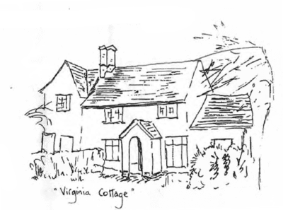
Easily overlooked in the village, this cottage and its neighbour are listed timber-framed buildings and retain several original features.
 35. The Grays
In 1854, this building was used as a boarding school with 14 pupils.
36. Bures House
The site of this house is mentioned in documents as far back as 1658. The land formed part of a larger area and gradually became divided into smaller plots. The area was originally known as ‘Hodges’ or ‘Hedges’ in the 17th century, then later known as ‘Rayes’ or ‘Raisins’ and more recently Heath House. The house itself seems to date from c. 1778 when a Samuel Seamans, a carpenter, took over the land and ‘a messuage or tenement partly erected’. Thomas Daniell of the Brewery family lived here with his sister early in this century.
37. Penneys
Formerly the Rectory, replacing the Old Rectory near Cooks Hall. The attached bungalow, was originally built on as a meeting room for the Churchwardens.
38. Firmins
A bus service was started from here in 1904 by a Mr. J. Darvill. There is an unconfirmed story that a ghost walks the premises!
Cross over Lexden Road and go into School Lane.
39. The Site of the Almshouses
Until recently a small cottage stood on this site. Behind the site, there were two fields (now part of the Larkin Daniel Memorial Field) which were called Workhouse Field. In 1772, mention was made of 3 almshouses on the Green, and it is believed that the site of these is in this area.
You are now back at your starting point, with the School and the Heath on your left.
Just click ‘back’ in your browser to go back to where you were.


 22. Upper Dovehouse Wood Field
 25. West Bergholt Hall
 35. The Grays