New Church Road Traffic Safety Plan
The aim of this plan is to address the safety concerns caused mainly by the irresponsible parking of vehicles in New Church Road, particularly in the area of the school, and to a lesser extent by traffic speeding in the area.
The areas perceived to pose a particular danger are:
- Parking around the junctions at each end of New Church Road (NCR) (A general problem which occurs at any time of any day).
- The excessive speed of traffic along parts of NCR at various times.
The following concerns are specifically related to school times.
- Parking at the junction of NCR with School Lane and parking in School Lane. Also in School Lane when PoorsLand is used for football.
- Parking at the junction of NCR with Church Close.
- Parking in a way which restricts vision of pedestrians at the exit of the footpath from Mumford Close to NCR.
- Parking in the area of the bend in NCR beyond the Zig Zag lines.
- The lack of awareness of drivers of the need for more care and consideration in the vicinity of a school.
No one measure on its own is likely to impact on the problem and so this plan has four components each of which needs to be implemented to achieve maximum benefit for the area.
1. Parking restrictions defined by yellow lines in the following areas as indicated above.
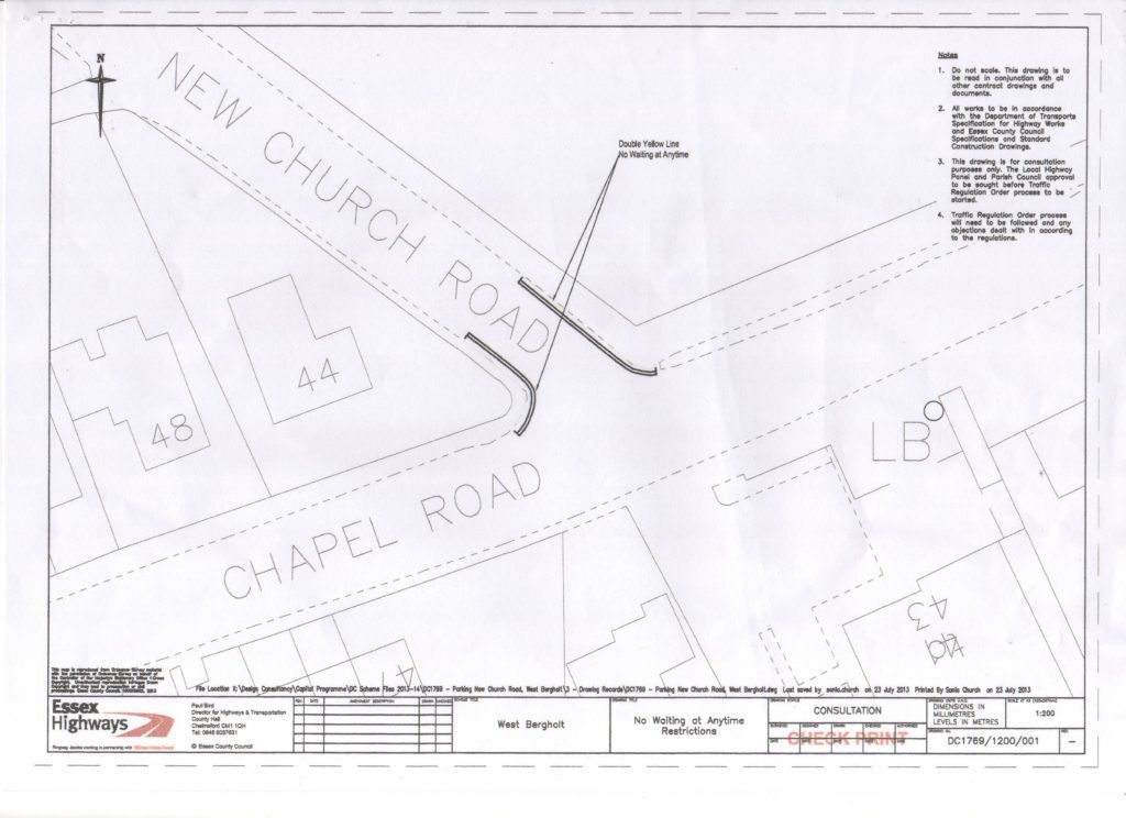
- Parking restrictions determined by double yellow lines at the junction of NCR with Chapel Road (see Appendix 1a)
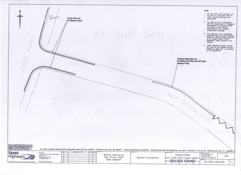
- Parking restrictions determined by double yellow lines at the junction of NCR with Lexden Road (see Appendix 1b)
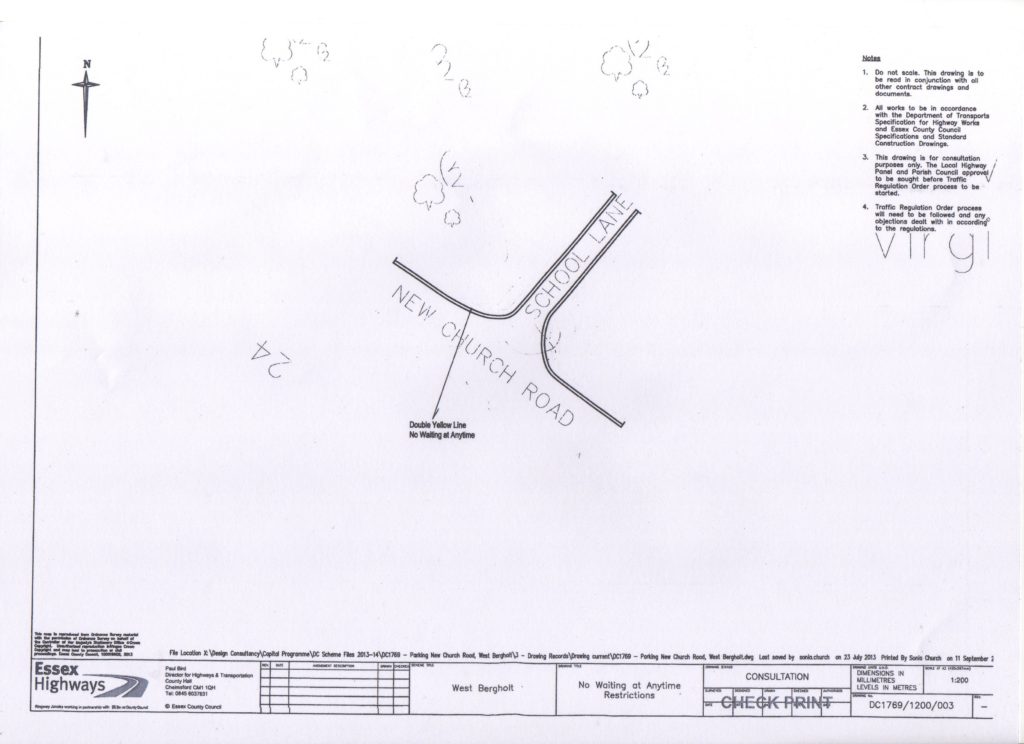
- Parking restrictions determined by double yellow lines at the junction of NCR with School Lane. (see Appendix 1c)
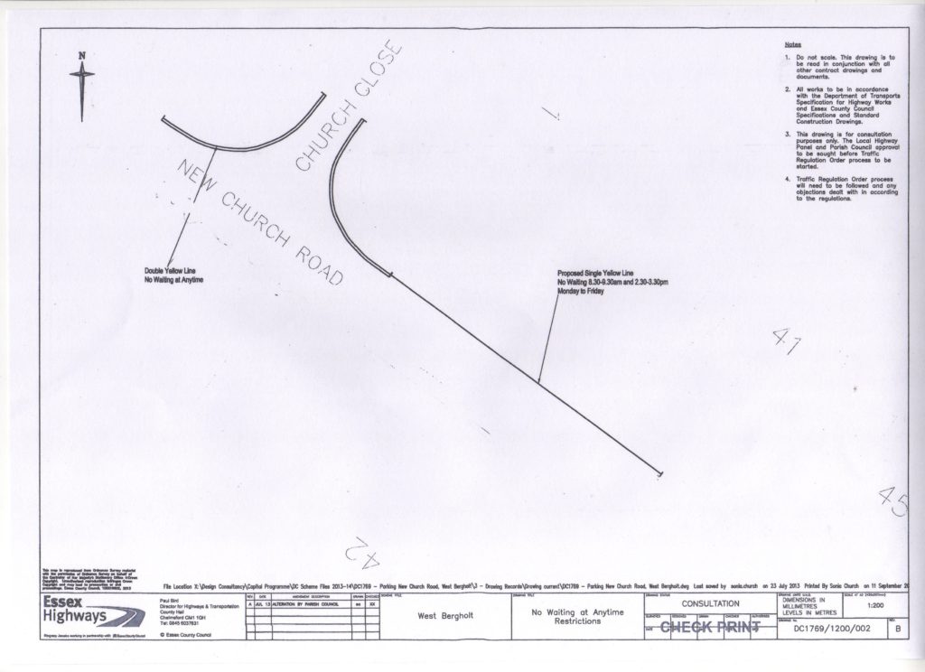
- Parking restrictions determined by double yellow lines at the junction of NCR with Church Close. (see Appendix 1d)
- Timed parking restrictions determined by a single yellow line on the East side of NCR from the exit of the footpath to join the lines at Church Close. (see Appendix 1d)
- Timed parking restrictions determined by a single yellow line from the Zig Zag lines outside the school entrance around the bend towards Lexden Road (see Appendix 1b).
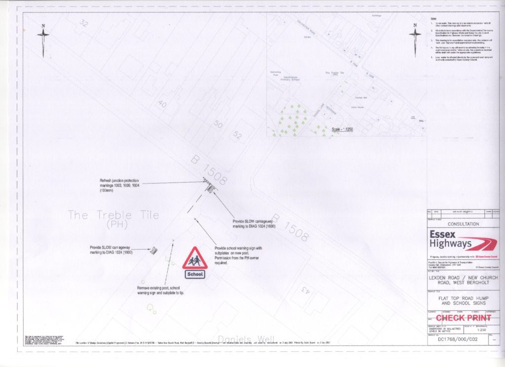
- Improved signage at the Treble Tile end of School Lane (see Appendix 1e)
2. Measures designed to influence drivers’ behaviour.
The aim of these measures is to raise drivers’ awareness of the special nature of the area of NCR, particularly the dangers that arise from large numbers of children accessing the school, and so to influence them to modify their behaviour.
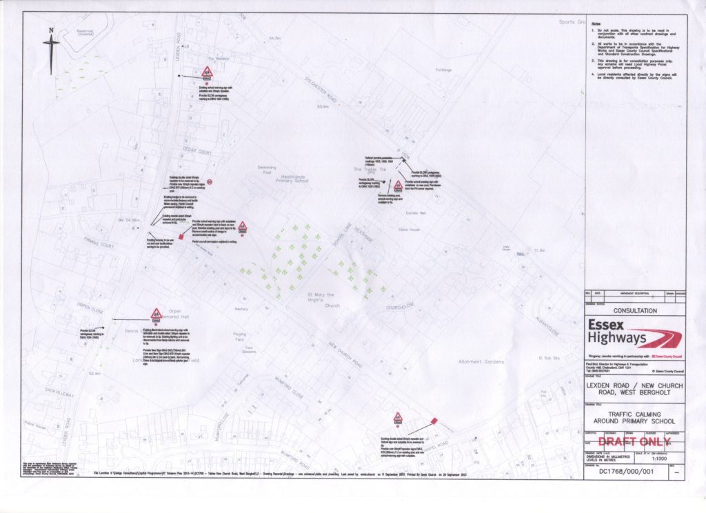
To make a statement of this intent red strips are to be painted on the road surface, 10 metres from each end of NCR accompanied by a suitable warning sign. The region defined should then become a 20mph speed limit area. (see Appendix 2a)
3. Measures to be taken by the school
Clearly the school has an increasing part to play in persuading and supporting parents who drive their children to school to achieve the changes needed in their behaviour. A School Travel Plan should look at ways of making walking and cycling to school a more attractive option. Issues such as staff parking should also be addressed. The Safety Plan envisages the school and its parents, local residents and the Parish Council working more closely together in the future and so a joint working party is proposed.
4. Measures to be taken by the Parish Council.
The Parish Council, working with the Borough Councillors, needs to make every effort to ensure parking restrictions are adhered to and enforced. As the school continues to expand the difficulties experienced at the moment could intensify.
Already alternatives for some dropping off and parking have been made but the Parish Council should continue to consider options that would provide more such spaces that are within reasonable access of the school.
The residents of the area have expressed their concern for the effect that some of the measures listed above will have on the character of the area and so this should be taken into account when deciding on the nature and extent of yellow lines and the placement and extent of signage.
Appendices
Click on the following images to see full size:
