Environmental Strategic Plan 2021-2026
This policy was adopted by the Council at its meeting on 25/11/20. For review annually.
1.0 Introduction
West Bergholt Parish Council (WBPC) has in the past been very efficient at managing the land assets under its control. Traditionally there has been a focus (probably too much) of keeping areas neat and tidy, and indeed this would be high on the list of priorities for most parishioners. However, there is an opportunity to manage assets in a different way – proactively and to take the opportunity to create areas within the managed environment which are rich in biodiversity.
The aim of this report is to determine where these areas are, what is possible to achieve with them, where the funds would come from and to determine what success would look like.
Our environmental plan should set goals for improving the village environment and leave it for future generations in a better more sustainable state than we found it. At the very least it should adopt and facilitate actions suggested in the Village Neighbourhood Plan.
2.0 Description of Trust land managed by WBPC
WBPC manages a number of separate areas of land, some of which are held in trust for the village. Parish Councillors are trustees for these land parcels and so make management decisions as required.
Lorkin Daniell Playing Field (1.98Ha) – An area mostly devoted to sport with a full-sized football pitch (for the local team), a recently renovated play area and a Multi-Use Games Area (MUGA). Around the outside of the playing field on two sides adjoining neighbouring gardens is a stand of mature trees with an under-storey of scrub. Along the boundary adjoining Lexden Road is a mature hedge comprising of hawthorn, elm and oak.
Poor’s Land (1.77Ha) – An area mostly devoted to sport utilised by the local youth football club with several pitches, the school for general sports activities – including the annual sports day and an annual firework display, organised by the PTA. There are mature hedges adjacent to School Lane and Colchester Road, and a scattering of semi-mature trees planted 20-30 years ago between the hedges and the football pitches.
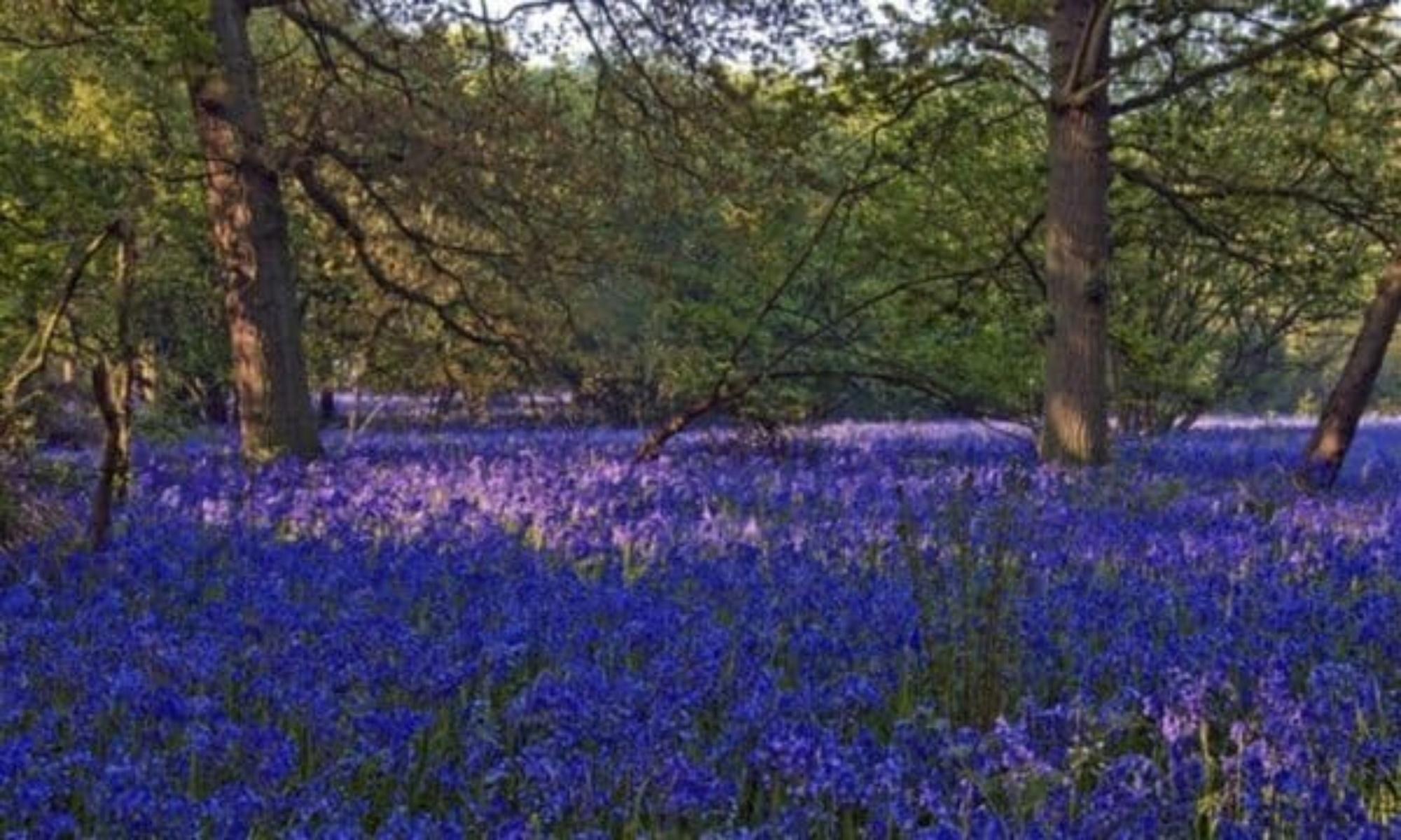
The Heath/Village Green (1.37Ha) – An area of dry/acid lowland heath (2), partially degraded by the encroachment of mature trees (mostly oak) and bracken. The area suffers high levels of pedestrian traffic from children and parents attending Heathlands school. However, this is a rare habitat in Essex and nationally and should be managed sensitively. In recent years isolated plants of heather (Calluna vulgaris) have been noted and encouraged to form a small but increasing patch. The Heath is bounded on two sides by a mature but degraded hedge. In 2018 Essex County Council’s Place Services were instructed by WBPC to carry out an ecological survey and to produce a management strategy (4). The recommendations from that document are gradually being implemented.
2.1 Description of other land under WBPC management
Ponds – The WBPC have managed the three village ponds for more than forty years which are considered to be of common ownership within the village. The Queen’s Head pond is a traditional duck village pond, low in biodiversity interest. The Lexden Road Pond is larger ‘wilder’ and has a small island. The pond in Hall Road is a former cart pond, having been used to park carts in overnight to keep the wooden wheels swollen so gripping to the metal rim. This pond is quite overgrown, and in particular infested with water plantain (Alisma plantago-aquatica).
Mumford Oak (0.75Ha) – An area of mown grassland surrounding a stately very mature, but healthy oak, separated from the Lorkin Daniell Field by a poorly maintained hedge.
The New Allotments (2.03Ha) – Surrounded on three sides by a mature diverse hedge.
There are some significant green spaces within the village that fall within Essex County Council (ECC) management, but for many years have been maintained by WBPC. Under a formal Highways Devolution Agreement, which includes a small financial grant, these areas are maintained by WBPC as necessary. These ECC owned areas include:
Greensward on both sides of Chapel Road at the junction with Colchester Road. This area accommodates the village sign and village beacon. These are areas of mown grass. A beech hedge was planted in 2019 on the larger section.
Entrance to the village when approaching from Colchester. There are two greensward areas along Colchester Road close to the ‘blue bridge’ – including a triangle of roughly mown grass with a couple of poor young ash trees. This area also accommodates the village ‘Welcome to West Bergholt’ sign.
Greensward alongside Colchester Road, adjacent to the Maltings Park development. The area is mown grass; however it includes many daffodil bulbs along its length.
Multiple road verges & greensward areas – Roughly mown grass at various points in the village.
2.2 Description of other land in West Bergholt
In addition to land managed by the Parish Council significant areas within the parish are managed by The Friends of Hillhouse Wood and the Woodland Trust. Large areas of green space are privately owned from farmland to private gardens, consideration of and inclusion in a greater Village Strategic Plan would be of considerable benefit to the wider environment.
3.0 Assessment of land under WBPC management
The UK Biodiversity Action Plan (UK BAP) was published in 1994 and described the biological resources of the UK and provided detailed plans for conservation of these resources (3). Action plans for the most threatened species and habitats were set out to aid recovery. Over the subsequent years the original list of species and habitats has been refined and added to. The current iteration ‘UK Post-2010 Biodiversity Framework’ published in July 2012, has succeeded the UK BAP, mostly due to devolution of UK nations. However, the list of species and habitats remain. There are currently 65 priority habitats in the UK of which the Parish Council is responsible for three if not four in our village.
Approximately 0.7Ha of land known as the Heath could potentially be an area of regional importance (UK BAP habitat – ‘Lowland Dry Acid Grassland’) for locally rare species (2). The survey undertaken by Essex County Council’s Place Services in 2018 also makes the case that the wooded areas around the heath land on the Heath ‘could be considered to be the Priority Habitat Lowland Mixed Deciduous Woodland, as they have a diverse structure and are composed of native species’ (4).
Two of the ponds (Lexden Road and Hall Road ponds) have quite a diversity of species although all of the ponds in the village are prone to drying out and becoming low in dissolved oxygen most summers. Although the village ponds do not meet the definition of ‘Ponds’ as a UK BAP priority habitat classification (as they are too small in area and of not high enough ecological quality} they are rich in wetland plant species and invertebrates. However, pending an ecological survey there is a possibility that they could be classified as UK BAP habitat – ‘Eutrophic Standing Waters’ (2).
The Parish Council maintains approximately 1.5Km of hedges mostly around the Trust land. The UK BAP habitat definition states that ‘All hedgerows consisting predominantly (i.e. 80% or more cover) of at least one woody UK native species are covered by this priority habitat’. Thus, the vast majority of hedgerows maintained by the Parish Council could be classified as UK BAP priority habitat (2).
Conversely most of the amenity land in the village is managed intensively, mown for sport or aesthetic reasons and suffers high pedestrian traffic. The Heath specifically suffers from its close proximity to the village school and high pedestrian traffic during term time. The Allotments by their nature are intensively cultivated.
4.0 Objectives of West Bergholt Environmental Strategic Plan
The primary conservation objective should be the maintenance and enhancement of the habitats under the Council’s control.
This plan aims to
- increase the diversity of species on land managed by WBPC and future proof and protect habitats
- identify, protect and enhance UK BAP habitat sites in the village in line with the UK Biodiversity Action Plan
- develop the village aesthetically.
- create a natural distinctive identity to the village and mark the village boundaries with natural distinctive features
- develop a volunteer force to aid implementation of the Strategic Plan
The timescale to implement the plan will be five years (2021-2026)
5.0 Recommendations
After consideration of the objectives of the Strategic Plan the following recommendations are made.
5.1 The Heath
The aim should be to restore as much as possible of the Heath soil type to a BAP habitat, accepting the limitations of the close proximity to the school. It is a relatively small site, much frequented in the centre of the village, however with careful management and discussion with user’s restoration is possible.
Maintenance of the extent of the Lowland Dry Acid Grassland will occur by preventing the establishment and spread of scrub and Bracken (Pteridium aquilinum) This will involve using techniques of land management to remove some of the invasive trees, cutting and controlling the bracken, coarse grasses and gorse (Ulex europaeus), allowing the areas of heather and associated heath land species to naturally expand their range. Initially a more invasive and frequent cutting regime will need to be adopted particularly of the bracken areas. It is suggested that ‘patch cutting’ should be adopted over the whole site to create a mosaic effect, this will maintain the habitat overall but still leave refuge habitats for vulnerable species (4).
Nutrient enrichment is a potential problem, primarily from dog faeces. Dog waste changes the inherent nature of the soil which creates the heath. A nutrient rich soil encourages coarser, generalist species at the expense of less adaptable heath land species. More dog waste bins should be provided, and dog-walkers encouraged to use them by explaining the value of the site, by using appropriate signage. To assess whether nutrient enrichment is a problem soil samples have been taken (appendix 1 & 2) which can be used as a baseline with which to compare future sampling.
Consideration should be given to how the area is viewed and valued by the local community. In particular to encourage an appreciation of the site’s importance for nature conversation, and to encourage local involvement in its management. Most importantly the issue of trampling should be tackled. Trampling of vegetation reduces diversity and eliminates less robust species, this is an acute problem adjacent to the school’s entrance. A working partnership with Heathlands school to help with the Heath’s conservation should be fostered, also to improve understanding of the character and value of the habitats present on the site and how best to protect them. An updating of the educational board describing the area’s species would be a great improvement.
5.2 Existing hedges
WBPC should accept that hedges are a BAP habitat and therefore manage accordingly. Long sections of the hedge surrounding the Heath (New Church Road and School lane) are degraded and ‘gappy’, these areas can easily be restored by planting saplings of native species such as hawthorn in the gaps. Whilst planting will fill the gaps and add to the integrity of the hedge as an environment, it will have an adverse effect on providing safe access to the school as these gaps currently act as ‘shortcuts’. For this to be successful a satisfactory explanation will be required to win ‘hearts and minds’ of children and adults alike.
Mature hedges are made up of mature trees reduced in size by regular hedge cutting and pruning. Standard trees of Hawthorn (Crataegus monogyna), Oak (Quercus spp.) etc. can be grown very quickly out of the hedge by selecting suitable shoots and stopping the pruning. As established trees they are not of course subject to drought so a large standard tree can be produced very quickly from within the hedge with one hundred percent success rate, and at no cost.
There are sections of hedges which have remained un-pruned and now have become ‘leggy’ and unkempt, with little wildlife value. For example, the hedge between the Poor’s Land and the Heath. This 60-metre section would lend itself to hedge laying, thus creating a better boundary between the two areas, and a far more valuable habitat for wildlife.
A regime of hedge cutting outside of bird nesting time has already been adopted. WBPC use a contractor to do the bulk of the work, with the handymen tidying up the more difficult to reach areas. Hedge shapes are critical in determining the number of species which can exploit the hedgerow habitat, ‘A’ shapes being the most productive. Where possible a move to ‘A’ shaped hedges should be adopted.
5.3 The Ponds
As discussed earlier the three ponds managed by WBPC vary considerably in their environmental interest and should be treated accordingly.
The Queen’s Head pond is a typical village pond in the heart of the village. It appears to be filled by rainwater and run-off via grips from the adjoining road and is thus prone to diffuse pollution. It is prone to silting and drying out and is often home to ducks which increase the nutrient content of the water. In the past goldfish have been released in the pond. Consequently, eutrophication is high every year. The environmental diversity is low however the area is attractive at the heart of the village. Clearance of Great Reed Mace (Typha latifolia) from around the edges of the pond should be undertaken annually and the surrounding hedges of Dog Wood (Cornus alba Sibirica) should be shaped to maintain aesthetic appeal. The isolated plants of invasive Goat willow (Salix caprea) should be removed. There is space to enhance the aesthetic environment with more feature hedging and bushes. The large Weeping Willow (Salix babylonica) needs pruning on a 4-5 year rotational basis to maintain its shape and health.
The Lexden Road pond is the largest pond managed by WBPC. It appears spring fed but is mostly filled with winter rainwater and run-off from the surrounding gardens and drives. The pond has a tendency to silt up and probably suffers from diffuse pollution. Great Reed Mace (Typha latifolia) domination is again a problem and 80% should be removed annually to allow other species to flourish. A large stand of Goat willow (Salix caprea) grows between the pond and Lexden Road, partly in the water. Although this is a beneficial habitat the invasive nature of the willow needs to be controlled. This area of willow could be greatly reduced, and a hedge established allowing a view of the pond from the road. The pond has a deep area (approximately 3metres deep) in the south west corner beyond the island and slopes to shallows at the northern end. This range of depths is very beneficial to a wide range of species. The shallow area lends itself to the building of a dipping platform reached from a boardwalk from the road, allowing access to the pond for educational and recreational purposes. Two Silver birch trees (Betula pendula) are established on the island as well as ‘crowns’ of Goat willow (Salix caprea). In order for the birches to survive the willows must be controlled.
The Hall Road pond apparently was created as a cart pond and is rumoured to have a solid base. Again, Great Reed Mace (Typha latifolia) and diffuse pollution (run-off via grips from the road) are problems, as is a recent colonisation of Water Plantain (Alisma plantago-aquatica). Due to its relatively rural and quiet location this pond appears to have the greatest spectrum of species of the three ponds in the village. Behind the pond is a stand of dilapidated disease-ridden elms (Dutch Elm disease spread by Elm Bark beetles). This area would benefit from being cleared of diseased trees and replanted either with resistant cultivars or other woodland species.
All of the ponds require regular annual maintenance during Autumn and Winter to control aggressive, invasive species to allow other less adaptable species to thrive. Currently the ponds are mechanically cleared when they become overgrown, normally approximately every five years; leading to the inevitable loss of wildlife and destruction of habitat. A more suitable approach would be to establish a team of volunteers who could work during the Winter months in a far less destructive way, whilst still controlling the extent of the invasive species.
5.4 Tree planting
Areas of trees have been planted on a number of occasions in the village with generally limited success. West Bergholt is situated close to the driest part of the driest county in the country. Between February and May inclusive the total average rainfall is just 146mm (5). Additionally, vandalism has been a major problem leading to the loss of a lot of saplings or at best misshapen trees. There are also few areas under WBPC or Trust ownership large enough to be suitable for the scale of planting required to make a significant difference. Although tree planting is currently in vogue and encouraged by central and local Government, the limited degree of success and lack of suitable areas renders it unsuitable for West Bergholt. The effort would far better be rewarded by restoring existing hedges and planting new hedges, which have been shown to sequester as much carbon and harbour similar number of species as woodland.
The next two sections (5.5 and 5.6) suggest options for the aesthetic appeal of the village.
5.5 Roadside verges
There are several areas of large roadside verges or greensward either within the village or on the outskirts which are suitable for the establishment of wildflower ‘meadows’, both for aesthetic appeal and to encourage pollinators. These areas are currently regularly mown and of practically zero environmental interest. Although wildflower meadows are labour intensive to establish and maintain, they have dramatic visual appeal when flowering and attract many further species. Wildflower areas at the boundaries of villages help delineate and identify local areas and are generally a popular addition to the local scenery.
The small areas of weedy grass growing between the footpath and the road along many of the village thoroughfares has limited visual appeal and environmental interest. Grass needs mowing for six months of the year and is drought prone during Summer months. However, these areas may be suitable for the establishment of creeping thyme (Thymus serpyllum) which flowers – providing nectar for pollinators and looks far more visually appealing.
Small scale trials of these two potentially attractive options should be undertaken to examine their long-term cost and feasibility in West Bergholt.
5.6 Feature hedges
Delineation of the village boundaries may engender community spirit and pride in a shared locality. Boundaries can be marked with natural features, the more distinctive and unique the better. West Bergholt has several points suitable for such features, generally close to the village signs on entering the village. For example, the triangle between Lexden Road and Colchester Road, the greensward to the North/West of the Blue bridge over the A12. There are also suitable areas within the heart of the village such as the greensward around the Queens Head Pond. A purple beech hedge (Fagus sylvatica ‘Purpurea’) has already been planted at the back of the greensward where the beacon is located to provide a backdrop to the area and to make this prominent village location more visually appealing.
As already discussed in this document hedges are far easier to establish than stands of trees, sequester as much carbon, and harbour similar volumes of species. They need pruning annually but ultimately are less costly to maintain than woodland, and do not need specialised purchased expertise. It has already been demonstrated in Winter/Spring 2019/20 that the success rate of hedge planting far exceeds that of tree planting. Hedges should therefore be the focus of our environmental improvements efforts.
5.7 Volunteers
The implementation of these suggestions represents a considerable workload, far beyond the time available to West Bergholt’s village handymen. To purchase the skilled labour from landscape gardening companies would far exceed available funding for projects within the WBPC annual budget, even if it was deemed by the Parish Council a suitable expenditure item. To achieve all of the objectives outlined in this plan a team of like-minded volunteers should be recruited from the village and perhaps local natural history groups. Working groups could undertake the work required under close supervision. Past experience with volunteer groups in the village have demonstrated the need for clear instructions to be given to enthusiastic volunteers.
During casual conversations over recent months members of the Environment committee have discussed the subject with various parishioners. Potentially a small team could be recruited, answering directly to a WBPC nominated Environment committee member to work towards the objectives outlined in this plan.
5.8 The Wider Environment
A process of engagement with green space owners both large and small should be embarked upon to leverage conservation actions within the village. Many parishioners feed birds and other wildlife as well as providing nesting sites and habitats within their gardens. Discussions with surrounding landowners may create opportunities to develop wildlife corridors between woodland areas on the periphery of the village, perhaps linking up Hillhouse Wood with private woodland.
6.0 Resources
Apart from volunteers two sources of skilled labour and expertise are available.
6.1 In-house
The village has three handymen, one of whom is becoming trained and is most importantly interested in tree and hedge management.
6.2 Outside resources
Place Services are a public sector provider of environmental assessment, planning, design and management services. They aim to help their clients protect and improve the natural environment and have worked with local authorities in Essex, London and the South East.
T&LC. are a local private sector company, often used by WBPC for their expertise in tree management. One member of staff has recently qualified to undertake tree risk surveys.
There are other landscape gardening businesses in the village, containing suitable qualified employees.
7.0 Funding for projects
Financially it is unlikely to be possible to fund environmental projects such as those described above entirely through the WBPC precept and budget. Other external funding will be required on a project by project basis and this being in addition to any voluntary resource identified within the village.
WBPC has a Finance Officer who has many years of funding and grant application experience. The Financial Officer has general knowledge of the various grants available within the county of Essex and nationwide. However, the aims and objectives can alter significantly from year to year and new short-term grants become available from time to time.
Almost all grant systems are broadcast to Essex communities through newsletters and announcements through organisations such as Essex Association of Local Councils (EALC), the Rural Community Council of Essex (RCCE) and the local authority social media channels of Essex County Council and Colchester Borough Council.
The WBPC clerk keeps a record of current funding agencies and the grant objectives. When a project is identified that requires external grant support in order to be viable the Clerk and Financial Officer will complete the grant application on behalf of the Council. In addition, the clerk holds the master register of projects planned for the financial cycle and monitors spending against the plan and reports back to the full council on a regular basis.
8.0 Measuring progress
In order to judge the effectiveness of the management actions and to amend plans if required over the five-year period the different habitats will need to be monitored. For the most complete reports Place Services could be engaged, although this may prove to be expensive. Alternatively, volunteers from local natural history groups or the environment volunteers might be tasked with monitoring progress.
At the outset of the environmental project a baseline record of existing species together with an indication of numbers should initially be established by mapping the BAP Habitat sites. The annual mapping of the extent of key species will be essential in order to measure any change in abundance and location over the five-year period. Using these data management actions can be modified if target species are found not to be reacting positively or as expected to the interventions.
The trials on roadside verges should be established early within the five-year period, so conclusions can quickly be drawn as to their suitability in West Bergholt.
Progress towards enhancement of the BAP Priority Habitats and establishment of other landscape features discussed in this plan should be presented to WBPC and the Trustees of the land in the form of an annual report. `
9.0 Conclusions
- The BAP habitats on Trust land and land managed by WBPC should be acknowledged and documented.
- Plans outlined in this document should be implemented to restore and enhance these features for future generations to appreciate.
- Whilst West Bergholt is a rural village, it has strong suburban influences and distinctive natural features. Delineating the village particularly from the nearby suburban community would enhance the village aesthetic environment and help improve the local identity.
- The workload and time requirement to implement this environmental strategic plan is beyond the Parish Council’s available man hours and funding. The only way to implement the plan fully is through effective recruitment of a team of volunteers enthused by village environmental improvement and prepared to partner with the WBPC Environment Committee.
- Progress should be measured via an annual progress report detailing outcomes achieved or recorded and presented to the Parish Council.
References
- Harvey, Neil. West Bergholt Heath Management Strategy. 2018.
- UK BAP Priorty Habitats. JNCC. 2019.
- UK Biodiversity Action Plan (UK BAP), History of the UK BAP. JNCC. 2019.
- UK Biodiversity Action Plan Priorty Habitat Descriptions. Defra. 2008.
- www.en.climate-data.org/europe/united-kingdom/england/colchester-6776/. climate-data.org. [Online]
Appendix 1
Analytic results of Heath and Wood soil samples.
 Loading...